

Issue 5 | September 2022 | Chronic Flooding Basics & Where it Comes From
By Josalyn Bonney, CSH2O Intern
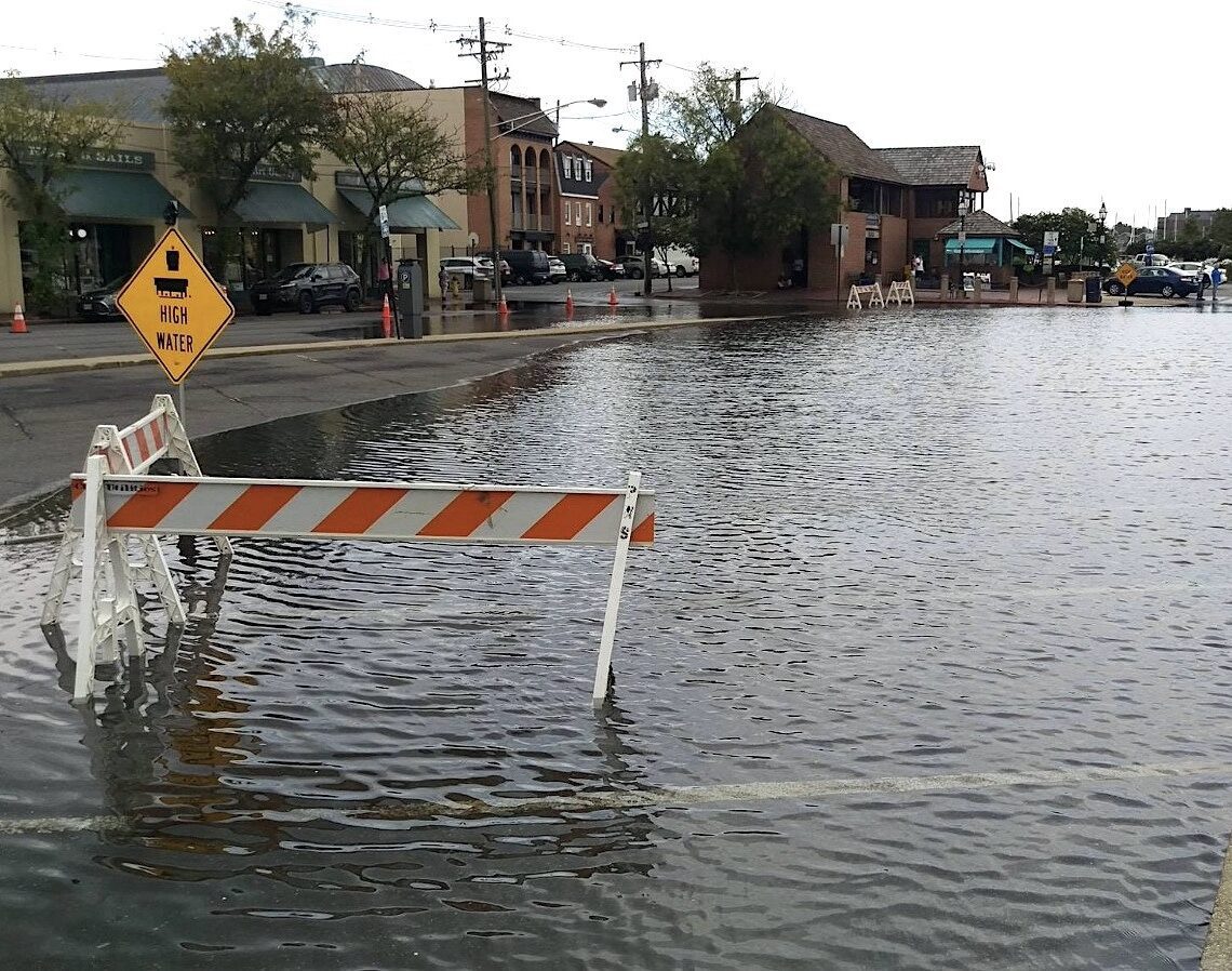
If you live in or visit Annapolis, you’ve most likely experienced how heavy precipitation affects the city. And if you’ve been downtown during or in the aftermath of a severe rainstorm, you’ve probably seen the mess that flooded streets have caused. Blocked roads due to an overflow of water have become a more common occurrence in recent years. Even within my lifetime of twenty-three years, I’ve seen how quickly things have changed. In the early 2000’s, only tropical storms or nor’easters could flood the streets. Now, it seems that you can’t drive downtown without hydroplaning after a hard rain.
While climate change is certainly a leading factor, is there another cause? What’s the difference between chronic flooding and an exceptionally high tide? A King Tide, according to NOAA (the National Oceanic and Atmospheric Administration), is “a non-scientific term people often use to describe exceptionally high tides.” 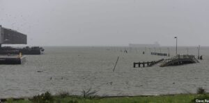 King Tides usually happen during a new or full moon and during specific, predictable seasons around the world. These tides are a completely natural phenomenon that depend on the alignment of the earth, sun and moon. This inconvenient flooding at high tide is also referred to as “nuisance flooding”. For more information, refer to the Maryland 2019 Nuisance Flood Plan.
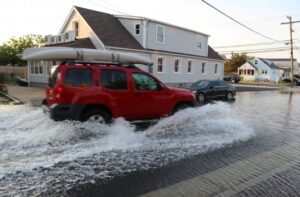 On the other hand, constant inundation of roads after a rainstorm is not normal, and as expected, climate change is the leading cause. As discussed in Chesapeake Quarterly, the rising seas have caused the Chesapeake Bay to increase its water-holding capacity about four millimeters per year. While this increment might not seem like much, the numbers add up over time; and their effects can already be seen.
Forested areas in the lower parts of Maryland are experiencing stress from coming into contact with water that is saltier than the trees can stand. Dead trunks can be seen more frequently than they have in the past, and shorelines are visibly shrinking due to rapid erosion. Unfortunately, it does not look like Maryland shorelines will get a break anytime soon. The coastal areas have some of the fastest-climbing rates seen in the United States.
There are several reasons why the Chesapeake Bay is more affected than other areas. Not only are the sea levels rising, but their temperatures are too; and 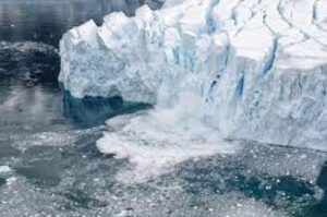 warmer water tends to take up more space than when it’s cold. Today, most of the Earth’s waters have higher temperatures than ever before. At the same time that the temperature is increasing, the land level in Maryland is sinking. This is partly due to erosion but is also a natural occurrence. The final factor is the least predictable: melting ice from the opposing poles. Unlike the slow and steady rise of the Bay’s waters, these glaciers are melting hundreds to thousands of feet every year.
While it may seem hard to believe that Maryland’s waters could be affected by something as far away as Antartica or Greenland, all waters are connected. With glaciers as big as the ones in the poles, they even have their own gravitational pull. Water around the base of the ice sheets is actually drawn towards them. When they melt, the sea level nearby will drop, but then it will rise somewhere else to keep the balance. Several gravitational influences put Maryland and the Chesapeake Bay right in the middle of its warpath.
It all comes down to slowing and reducing climate change by reducing our personal carbon footprint. Though that may sound difficult and overwhelming, it doesn’t have to be. Click here for a list of simple things you can do to help reduce your carbon footprint and do your part for the planet!